
Site Nv2
Site NV2 is located on South Creek below Broughy’s Bridge, North Arm Road, Bowraville
Our macro volunteers have tested this site for macroinvertebrates at Muster 8 and 9.
Thank you to those who have gathered macroinvertebrate data for site NV2.
Canopy Cover

NV2 canopy cover
Site Map
How to read our Water Quality Graphs
We interpret our water quality data by the method set out in this table to create bands of Very Good, Good, Fair, Poor and Very Poor.
Bellingen Riverwatch raw data is also available here.

Nv2 Macroinvertebrate Data
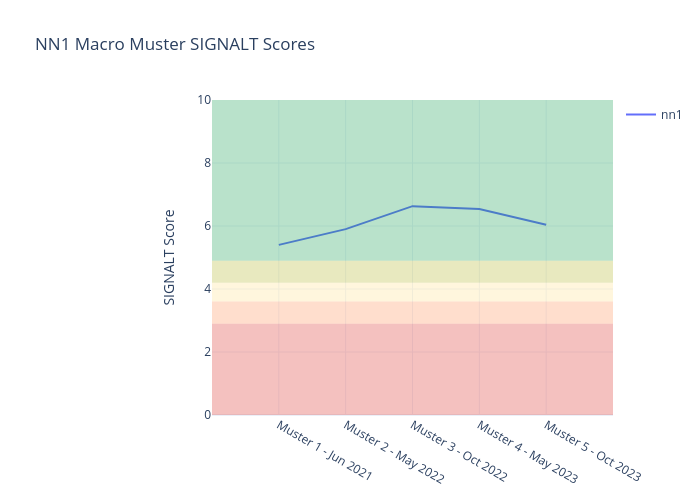
NV2 SIGNALT score .
NV2 SIGNALT Scores
Muster 8 - Jun 2025 - 5.14
We report on our data to help influence policy and decision making, and educate the community, now and into the future.
Note - Our raw data is shared with with the NSW Government Saving our Species recovery program for the BRST and is additionally available at both the Waterwatch portal and the DPIE SEED portal.
Raw Data
Our raw data can be found at the links below :